Monday 30 July 2012

Pigeon Island and Charity Shoal, Wednesday 18 July, 2012


Pigeon Island and Charity Shoal
Wednesday 18 July, 2012

Just getting back from a week away with family and friends at Snug Harbour in our little cabin on Desert Lake. Now it’s time to get back into the Lighthouse project, with lots of blogging yet to do, I was starting to feel guilty for taking my time getting the outdates completed. Then my voice of reason ( Mollie) reminds me that this project was to be about the journey and I have to admit, to date it has been an awesome journey. A journey shared with new acquaintances “ Shore People “, good friends “ Paddle Buddies” and my awesome loved one “ she who most be obeyed “ Mollie.
I was not going to paddle this week but on the 17th I just happened to check the marine forecast as I do most nights. I could not believe what I was reading winds 10 knots South, Southwest with waves 1 meter dropping to ½ meter starting middle morning. This was the weather I’d prayed for to get Pigeon Island completed. Looking at my maps, in a perfect world I could possibly get both Pigeon Island and Charity Shoal done in one trip. In a perfect world, what are the chances. Not wishing to miss this opportunity I phoned Brent, he is normally off on Wednesdays. I would love his company and it’s always good to have a companion on trips like this one.


Brent was home when I called and yes he was off the next day, which was Wednesday the 18th . As much as Brent gets excited, he expressed a keen interest in paddling to Pigeon Island Lighthouse the next day. I mentioned the weather report and we agreed that an early start would not benefit us. We planned to pull out of the laneway at 10:30am, which meant starting to load up 09:30am. As it turned out we were on the road at 10:24am once again heading to the Wolf Island Ferry.


While waiting in line for the ferry, I took the opportunity to photograph a few of the shore birds on and around the ferry dock.


Roof Tops


Can you see it, look hard.  I never noticed it till after I took the photo.


Greg & Beth Caldwell


This is when I had the good fortune of meeting the nice couple in the car ahead us in line. Interested in our lighthouse project, Greg & Beth Caldwell who live on Wolf Island promptly started providing us with needed information. Our quick decision do this paddle, left little or no time to research the basics. So Not Us!!!! we were winging it. This chance meeting was meant to be, Greg was a fountain on local knowledge and he provided answers to many of our planning questions.


Summer Trips on the Wolf Island Ferry
are always full.


Once again, on the ferry heading to the Island, Brent mentioned that he really enjoys this short ride across to the Island.


Armed with Greg’s suggestions we headed for Ease Lane Rd. Ease Lane Rd is a private road that actually follows along the shore of Reeds Bay and stops at the walking trail to Long Point which is about 2.6 kms to its end. The most westerly point of land on Wolf Island and the closest point of land to Pigeon Island. We get to Ease Lane Rd. at the home of Greg’s suggested contact, he was not home. Saddened we turn around and start back in land along Ease Lane. Brent says, look a Kayak on the roof of that car. The car was parked in the lane of one of the shore front homes. I stopped to look and noticed people sitting at a picnic table next to the shore.

I pulled off this small gravel road into the their lane. I get out of the truck and say to Brent they are kayakers maybe they will let us launch from their property. I walk around the house to the waterfront, apologizing for the intrusion I quickly introduced myself and mentioned what Brent and I were doing. I’m not sure what I would have said in their place, but this kind family were so gracious. They welcomed me in and without hesitation said they would love for us to launch from their boat ramp.


Denis & Linda Myers introduced themselves, they explained that property was a rental cottage and they have rented it for many many years. Denis was a Wolf Islander years back, raised in the village of Marysville they come back every summer for a holiday visit. The question is “ do you ever stop being from that childhood home or village “ They now live in Perth.


Brent and I off loaded the kayaks and gear. While going back and forth I noticed Denis had more then a passing interest. Of course what was I thinking he is a paddler, he may wish to join us. Linda finally asked to him quietly, would like to join them. Hearing this I said to Denis would you like to come along. Denis said thanks, but he had promised the family a hike into Big Sandy Bay Park and go swimming at it’s beautiful beach.

Prior to climbing into my kayak I traded e-mail and phone numbers with Denis, and Linda, just in case they were not back from the beach when we completed our paddle. We all wished to keep in touch. Sometimes a person or persons you happen chance to meet, just seem to connect and you hoped you will have the good fortune to meet them again. Denis & Linda were such people. 


Launching with our host Denis watching. 


As we launched off their ramp which was really very good, a rock shelf next to a pier made of boulders, Denis asked is there a time we should start to worry or call someone. This is an experienced paddler talking, we gave him our time line and thanked him for his concern.


We are off, Brent and I start to paddle the 3.1kms from the cottage to the end of Long Point. At the tip of Long Point is where our paddle in open water will start.


As I normally do in the first few minutes of a paddle, I do a check of all my gear. First time ever this has happened, I noticed I have forgotten my spray skirt. Looking at the GPS I see we have already paddled 1.2kms I start the mental debate whether to turn back or not. Staying with my gut and years of training “ only a fool starts out without all the correct gear “ plus my promise to Mollie that I would always “ error on the side of caution “ we turn around. Arriving back at the cottage so soon Denis comes down to the water to meet us asking if everything is alright. I mention the spray skirt and he agreed it was wise to come back.


5 kms off of Pigeon Island 


On our way again the GPS says 9.98kms direct line to Pigeon Island. It seem Brent as well as I feel the need to cut some water. We do short work of the first 3.1kms and cleared the tip of Long Point in about 37minutes. Clearing the point we hit open water, Pigeon Island visible straight ahead but more of a surprise we can actually see and very clearly, Charity Shoal lighthouse to our left.


The Dogger checking out Pigeon Island 


Could we be so lucky. Keeping my thoughts to myself I’m just pleased that we are getting Pigeon Island done. With gentle winds and waves ½ meter minus life is good.


While paddling along to Pigeon, Brent and I chat about everything from our good luck in weather to Brent’s education plans. But it seems our conversation always came around to how close Charity Shoal looked and how calm the winds and waves were.


Getting close and we can start to smell the Island,  We are just under 1 km away.


Rob Holding the MS Flag off shore,
under Pigeon Island Light.  Not one pigeon to be seen.


At approximately 13:10hrs our kayaks glided up to Pigeon Island. We had planned to get out and walk around the island, check it out. Then again as we got close to the island we thought better of this idea for a few reasons. One we were frightened of catching something from all the wet bird shit which painted the island slimy white. Secondly the shore rocks were covered in the sloppiest algae I’ve ever seen, you could not get any safe footing.


Brent watching the birds and hoding the MS Flag.


The last reason, we had made the decision to paddle on to Charity Shoal. Yeppers, as we were paddling the final few meters up to Pigeon Island I asked Brent what do you think about trying for Charity. He looked at me and said “ when will we get another day like this “ I thought to myself right answer young man.


We took our MS Flag photos of Pigeon Island light and allowed ourselves to float off it’s shore for a few minutes. Enjoying the moment, I mentioned to Brent “ we will likely never come back here ever again “ so we sat take it all in, the shit covered white rocks, the many types of water foul and the light.


Sitting off the island chatting, Brent and I thought this light was well designed for this location. It’s designer allowed for strong winds, even waves to pass through the structure without any damaging affect on the light. Very, very smart. We also tried to take in the hundreds of birds flying closely overhead, Brent said lets go. I thought to myself, Brent is frightened. He does not want to have a bird crap on his head….smiling.


Charity Shoal is out in front of my kayak


Taking a GPS reading it said we had a 6.88km paddle to Charity from Pigeon Island. Somewhat different then my map guesstimation, but I was not far off.  During our South Southwest tack to Charity Shoal the winds literally stopped and the waves started to lay down, I can’t believe how lucky we have been. Every action has a reaction….. right. No wind meant a hotter paddle. I’m ok with lots of sun block and water.


I look ahead to my left and the Dogger is maintaining a great pace, youth!!!! As long as you feed him, he is like the Eveready Bunny. Really, I’m thankful to have this young man as a nephew and paddle buddy he is fun to be around.


What a day, we are going to get two lighthouses done, not one but two. Again I look over at Brent, I was blown away by the awesome view of Wolfe Island with all it windmills.


Half way to Charity Shoal.  I was hoping to get it in as well, you can tell by my map......The Island ahead in front of the my kayak.


One in a million photo.  Lake Ontario so flat,
Brent, freighter and Charity Shoal Lighthouse.
Awesome!!!!! 


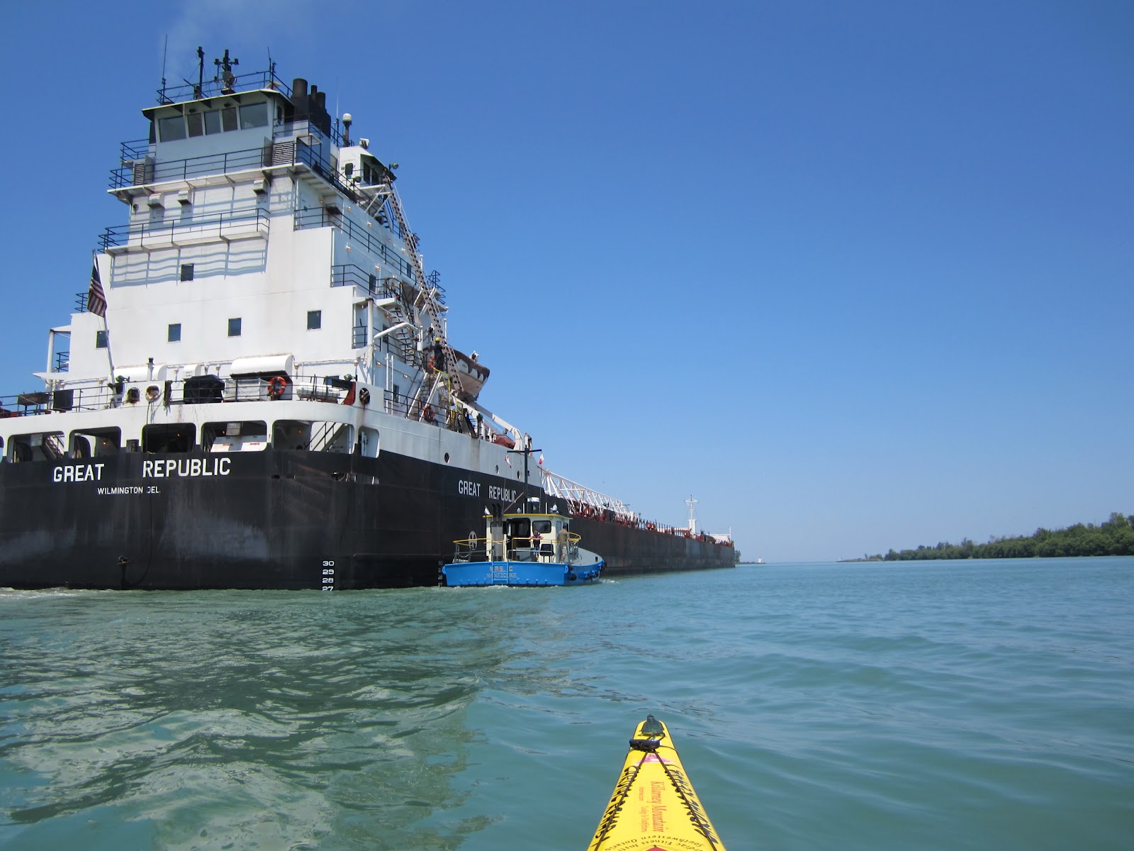
Around half way to charity I notice a Freighter Ship coming out of the Lower St Lawrence River between Wolfe Island, and Cape Vincent, NY. What a sight, Brent the freighter and Charity Shoal lighthouse, this will be a once in a lifetime photo.


We get to the Charity Shoal by 15:15hrs / 3 :15 pm. The water and skies have so much colour I take many many photos. Once again who knows if we will ever have the opportunity to come back and see it so beautiful. We decide to have a floating lunch because climbing out of our kayaks onto the Shoals slippery poop covered rocks did not have much appeal.


Rob in front of Charity Light.  I love this lighthouse.


Brent with the MS Flag, Charity Shoal Lighthouse.


After drinking lots of water and munching down all our lunch we headed for Wolf Islands Long Point.


Windmills in front of my kayak,
head to Long Point


Our GPS states that Charity to Long Point is a 7.7km paddle as the Cormorant fly’s. It was hear that Brent and I said wouldn’t it be great if the winds started. Well we had paddled about 4kms of this leg when a slight breeze started pushing us, the waves increase in height. We love the paddle gods.


Now about 2kms off Long Point the winds had increased to the point where we decided to try the sail that Mollie had made us. We have used this sail many times before and know that we can cover great distances in a very short time, with little effort. With sail up, we rounded Long Point doing around 5.5 kph.


Long Point ahead we are under sail.


Then headed into Reeds Bay to our launch point. Can you believe we sailed the last 5.8kms of this 33km paddle day, life is good.


The question here is, can two paddlers have a perfect trip, I can now say yes. Had I not forgot my spray skirt, would we have caught this southwest wind on the way back. Who Knows?


Just about 1 km off shore we pulled down the sail and paddled up the pier where Linda our launch host, happened to be leaning on the rail taking photos of us coming in.


Linda took this photo of Rob arriving back at the launch. We got her done, both lighthouses what a great day.


Brent at the end of the day, Yeppers 33kms ............ Feed Me!!!!!! I'm hungry.


We got off the water 19:20hrs / 7: 20pm making this a 33km paddle over all, with the mini round trip for my spray skirt…..smiling. About 7 hrs total, with floating around taking photos and having lunch on the water. Not a bad day. On shore now, Denis and Linda provided us with a fresh drink of cold waters, Brent texted his Mother telling her and Mollie we were off the water safe and sound. Not having to worry about folks back home worrying, we sat and chatted for a good hour with our hosts, just getting to know them.


I’m thinking now is a good time to tell you about Denis and Linda. Both very accomplished in their passions. Denis is more then a social worker by day and on weekends a solo canoeist, who has paddled some very challenging white water rivers. I know I could learn a lot from Denis about paddling this type of water. Linda is a Graphic Designer who’s real passion is painting in watercolours.


Linda Myers,
 While chatting this humble couple very casually mentioned their hobbies. I had to press Linda to see her art and Denis to give me links to his photo's. Just an amazing couple. “ Shore People “


Linda has painted many of Perth, Ontario’s historic buildings. I will attach her Facebook Studio link with her permission. https://www.facebook.com/media/set/?set=a.10150132801998554.323076.648608553&type=3&l=aedf8ef19a


It was hard to leave such nice people, but we did have to get going home. We said our good byes and headed to Marysville to catch the Wolfe Islander. 

Windmills just outside Maryville Wolf Island


On the trip across the island Brent and I once again had the debate on windmills. As it turned out we both felt positive about them, I personally love the look of them on shore and in the fields.


How can this be a bad thing?


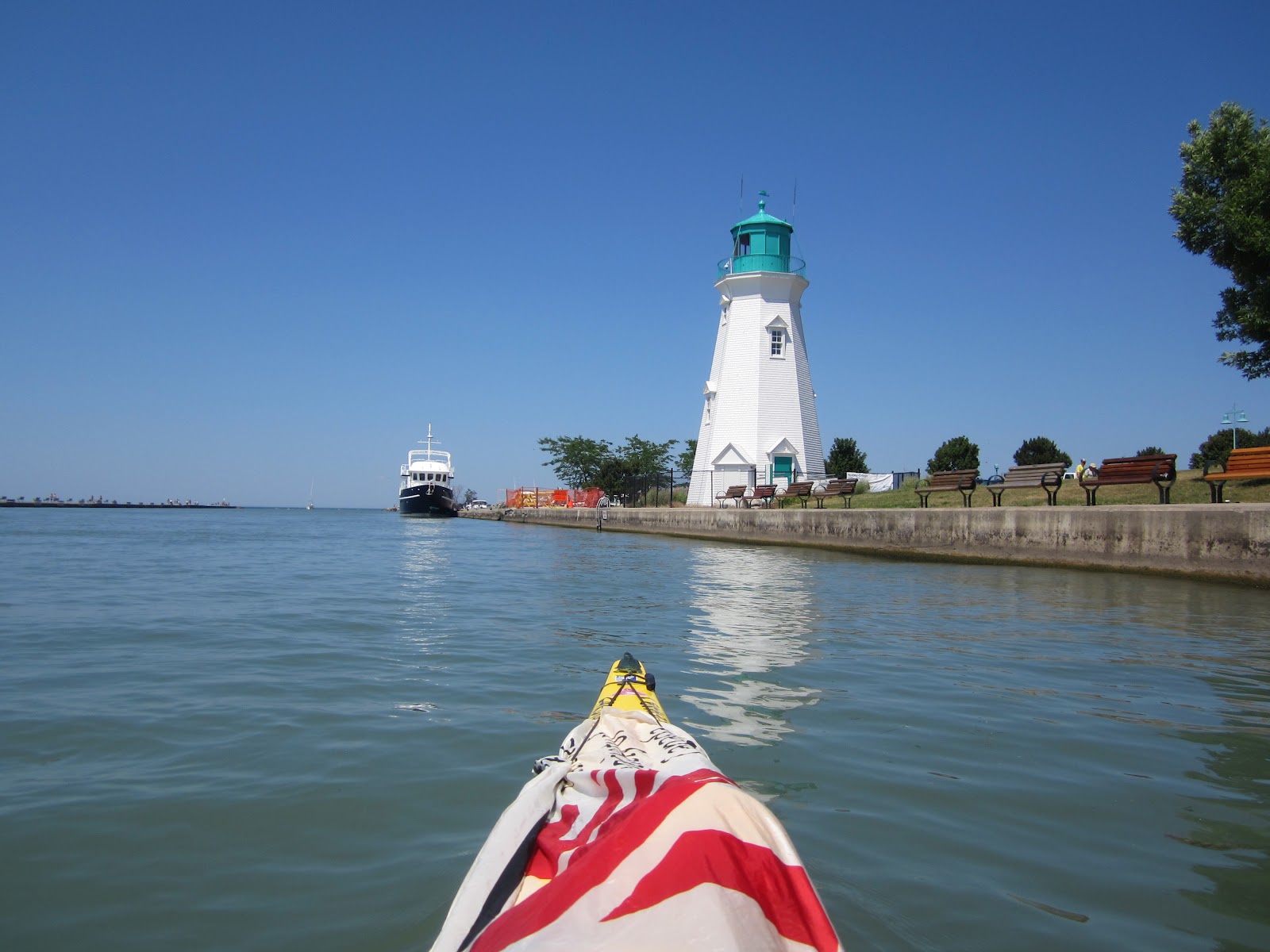
While waiting for the evening ferry all waiting were blessed with the most beautiful sunset.


Skies over Lake Ontario, while crossing from Wolf Island to Kingston.  They just kept increasing in beautiful. I know no words that can truly describe how magnificent a day Brent and I shared.


Life is awesome today.


Out Takes Photo's


 This leaves 6 Lighthouse to paddle.  

Once again folks remember we are raising Awareness & Funds for the Multiple Sclerosis Society of Canada, Kingston Chapter. If you wish to make a donation/pledge please call the Kingston Chapter at 613-384-8500 . Tell them you wish to pledge to
“ 20 Years To Enlightenment “ and it all stays in the Kingston and area.

Saturday 28 July 2012

25 - 29 June, 2012 The South Shore Lake Ontario New York State, USA Day # 5


25 - 29 June, 2012 The South Shore Lake Ontario
New York State, USA
Day # 5

Sorry folks for taking so long getting this Blog updated, please enjoy and remember
clicking on photos enlarge them

Day # 5

I was up with the sun as expected, having had my breakfast I broke camp and stopped at the Park’s showers on my way out. Feeling clean as a new nickel, I was back on Hwy # 18 heading west by 06:57. I was not down the road more then 15 minutes when my GPS chimes up. Another Seaway Trail Cache, I rolled into the very small village of Somerset, a pretty village which shows owner pride in their homes.

One of the homes in the Village of Somerset 

 This was the cache I had been waiting for, an easy cache to find from what I had read, but just sounded interesting. The cache is a Travel Bug ( TB ) Hotel, now I have visited a couple of these caches in past, however never one that sees TB and Geocoins visits like this one. My GPS chimes again. Now reading 52 ft away, I pull to the side of the road in front of this beautiful old farm house. I get out of the truck and cross the road with GPS in hand, I’m walking along a very thick rose bush hedge on this private farm lane. As I reach the cache location, I look up and watching me were a couple having coffee on their side porch. They wave and I wave back saying good morning. I kept looking and there it is, hidden in the rose hedge is a full size green plastic rural mail box. I could not believe that this hefty cache was so well hidden, yet so open. I opened the door and I really could not believe my eyes, it was a treasure trove of Geocoins and TBs There had to be 4 dozen. I sign the log and then went about selecting the TB I wish to take along on my travels. I selected a interesting looking Geocoin it was a Groundspeak Lackey 2009. I left a wooden coin I had retrieved close to home. I closed things up and chatted with the farm owners for a few minutes. They told me that they could not get out caching as much as they liked, being dairy farmers and having to stay close to home. So they thought they could meet folks if they placed out a TB Hotel. They have been so happy with the results, they get to meet so many people right on their door step. What nice folks, I did not get their names or take a photo I’m sad that I didn’t.


A few minutes down the road I hit Hwy # 78 and my turn into the village of Olcott. I drive down Lockport St to it’s end and drive right up to the lighthouse. This small Lighthouse looks over Lake Ontario on the shore side and the touristy main drag called Lockport St. village side.


Once again I’m out of the truck with GPS in hand in search of another Seaway Trail Cache which is located on a small board walk at the creek’s edge. Back in the truck I cross the bridge over Eighteen Mile Creek and turn off onto Water St then into Newfane Marina. As I pull into the marina launch area, I noticed a cheerful looking chap sitting on a lawn chair by the Marina Office/Store.   This gentlemen, I find out to be Bob Sweeney. After telling Bob what I was up to, he said launch and watch the Lake it’s up a little today.


Newfane Marina on Eighteen Mile Creek


Gear loaded in the kayak I launch and start paddling up the creek “ with my paddle “. The creek north of the launch to Lake Ontario was lined with docks, that moored fishing boats.


Chris and his friends


As I break out into the lake I meet four young paddlers, Life Guards from the Olcott State Park Beach out for an early morning paddle themselves. What an interesting group, all in collage doing the summer job thing in Olcott . While bouncing along on mild Lake Ontario swells they share their stories as to where they were from and their thoughts for the future.


I know how did that happen a photo of me


After this energetic foursome found out what I was doing, they asked if they could join me on my small lighthouse adventure. As always I love company, so off we went.


Arriving at Olcott Lighthouse with fellow paddlers.


Arriving at the lighthouse I get what I think are great images of the lighthouse with the MS Flag laying across my deck. While capturing these pictures Chris Eglinton is educating me on Olcott and it’s history.


He mentioned things like :
Krull Park in the northeast part of the village, is the largest county-operated park in Niagara County. Olcott was known for its Coney Island-like beach attractions and attracted tourists visiting nearby Niagara Fall, New York  Many of these attractions have closed, however, after the decline of the City of Niagara Falls and a prolonged economic downturn which has hard-hit all of Niagara County. Slowly, efforts are being made to bring back this economic prosperity that the region once saw, and so far has been a success in Olcott. Heritage tourism has become quite popular in Niagara County, and new festivals include the Olcott Pirate Festival as well as a famous car show that takes place during the summer.


Chris with morning sun behind him.


I was enjoying this young man’s company, plus it’s easy to see that Chris is an accomplished paddler by the way he sat and manoeuvred his Necky Looksha in the Lake Ontario chop.


Photos taken we turn to head back to Marina, but not before we as a group play around in the waves for awhile chatting.  This young lady paddled this board as fast as we paddled our kayaks.


Just a little wave action, it was all fun in the morning sun.  Hot summer days to remember in the future.


Fun in the sun!!!!!!!!


I say my good byes to Chris and the group at the mouth of Eighteen Mile and paddle back to the Marina.


Bob & Bert Newfane Marina Olcott


08:58am The kayak/truck loaded, I stop by the office to say thanks to Bob and Bert " Bert Carlson the better looking one ".   It turns out that a fresh pot of coffee was just made and sitting on the coffee maker. Bert offered coffees all around so we sat chatted about Charter Fishing, the Olcott lighthouse and the village of Olcott in general.


It was hard to pull myself away from all the great stories, tall tails of fish caught and not, however I felt a pull to get on down the road.  I was eagerly looking forward to paddling the Niagra River group of lighthouses. I thanked Bob, Bert and the gang for the stories, launch and coffee and I was off. Yeppers ‘ Shore People “ and now “ Water Folks “ Chris and fellow paddlers.

Back on Hwy # 18 it was a short 20 miles to Fort Niagara and the Fort Niagara Lighthouse. Arriving at Fort Niagara State Park the first thing I noticed on the Parks info Board was it had a boat launch. Fort Niagara is much like Fort Henry in Kingston, but on a much grander scale. Driving north to the Fort which is located on the shores of the Niagara River and Lake Ontario I was in search for directions to the boat ramp. Finding what I think is the launch booth/road at the top of a hill leading to the water. I stopped behind what I thought was a park ranger vehicle with two occupants who where chatting with the young lady in a booth. I get out of my truck and start to walk up to that park vehicle, ready to ask where the boat launch was. However before I got to close the driver and the passenger exited the Jeep and asked if they could help me. Not park staff but “ Border Police “ hummmmmmmm. Quickly thinking this works for me, I first asked about the launch location which I was told “ follow this road to the water and launch“ . I then mentioned that what I was doing and would there be any difficulty. Note : At this time I was unaware that the Canadian Lighthouses were so close to Fort Niagara lighthouse.


The younger of the two border police, a P Bak Sklener stated that I would have to call Compass US & Canadian sides and tell them I would be crossing over from one side to the other. I mentioned to Sklener and his senior partner J Stanko that I did not have a phone and asked is there one close by. I also told them that I had tried doing this on previous paddles and they basically did not know what to do with me, as I had no boat registration number to give them. I told Stanko that it was very frustrating as I wish to do the right thing. Stanko understood what I most have went through so he pulled out his phone and called into the Border Patrol main offices. He told them what I was doing and that I was not going to touch shore on the Canadian side just paddle over and back. He got the Ok and then he gave me their badge info, saying that if anyone from the US side questions me to have them call him or the office. This large intimidating man was actually very understand, Stanko and I chatted about our time in the service. He had also retired from the air force before going into Border Patrol. I thanked them for all they had done and for bring me up to date on the laws on border crossing by water.


Niagara River Front & Rear Range
Canadian side


Following the short road to the water I could not believe my good fortune. The Fort Niagara boat launch was right across the Niagara river from the two Canadian lighthouses and the Fort‘s lighthouse was about a 2 km paddle to the north at the mouth of the river. Are you kinding me? I will be able to do all three lighthouses from here and could actually have them all done with in just over a hour if I wished.


I was expecting to do Fort Niagara, then have to load up cross the border and find a launch on Canadian soil and do the Niagara River Front and Rear range. With this new knowledge I felt at ease, I took my time to launch. While off loading my kayak I began to understand how the border patol would know if I touched Canadian soil. Cameras and lots of them on towers all along the shore and as I found out later, on both sides of the river.


Fort Niagara Lighthouse from the water


With light winds coming from the south I decide to paddle from the launch out to Fort Niagara Lighthouse. Arriving at the lighthouse I found myself paddling up and down the shore line, trying to get a decent photo of the complete lighthouse tower it was not going to happen, trees had grown and over the years began to block a good part of the lighthouse from view at water level.


MS Flag Photo at Fort Niagara


I took my MS flag photos anyway and then did the tour thing, paddling up along the shore to the fort. As for the lighthouse photos I will get a better shot, from inland while touring this beautiful park.


Fort Niagara completed I head southwest across the river to take in the two Canadian, Niagara River Front and Rear lighthouses.


Niagara Fall Whirlpool Jet Boat


As I approached the Cdn side of the river a very large Jet Boat was starting out with a load of excited thrill seekers on board. It was the Niagara Falls Whirlpool Jet Boat, this tour can only be described as one of the coolest things to do in this area. The Jet Boat takes you to the whirlpools at the base of Niagara Falls, simply it‘s a splash and crash ride with a little local history thrown in.


Niagara River Front Range Lighthouse
Canadian Side


The Jet Boats energized passengers began to wave when seeing me taking their picture, how cool. With them pass and heading down river I continue on to the Front Range Lighthouse. The Niagara river lighthouses were about the cleanest Cdn lighthouse so far. I guess being a tourist area, it gives the locals a reason to keep them well maintained.


Front Range Lighthouse


Sliding passed the Front Lighthouse I took a few photos and then paddle to on to the Rear Range Lighthouse which had to be no more the 500 meters south towards the Niagara Falls.


Niagara River Rear Range Lighthouse
Canadian Side


I’m very conscious of the fact I’m not allowed to touch Cdn soil. Once again I’m reminded that big brother is watching by the camera visibly mounted on the Rear Range Lighthouse which slowly rotates back and forth, up and down the Cdn shore.


Camera On Rear Range Lighthouse


I decide to stay well off shore to take my photos. At this point an idea hits me, wouldn’t it be cool to paddle up to the falls or at least to where I could see them. As fast as the idea came it went. A Cdn Police Boat came cruising past with three officers on deck, they came my way but not right up to me, for sure it felt like they were closely checking me out .


Fort Niagara from Canadian side of the river


 I waved at them and turned east to head back across to the US side. I knew their border people, were knowledgeable about what I was doing on the river so I actually felt safer there.


Fort Niagara Lighthouse


Back at Fort Niagara with kayak all loaded I was sitting at a picnic table having my lunch of apples, cheese and my last home made tea biscuit which I might add was getting a little dry. While eating I watch an older couple trying to off loading their new boat, they where having a difficult time, so I offered to help them and they said “ oh please do “. After showing them what I though they needed to know and do before they launched. When they actually launched their boat they did it like pros. Very pleased with themselves, the two of them came over to the picnic table, to thank me.


Fort Niagara Lighthouse


 While chatting I asked if they knew a place close by with good gas prices. They drew me a map to the Reserve which just happened to be on my way to the Niagara Fall bridge to Cdn. We said our good byes and I went for a drive through the park and found the Lighthouse and took some photos.


11:04am I was on my way to the Reserve, I know 11:04am how could that be. When I arrived at the Joes Gas I could not believe the price of gas, $ 3.31 a gallon. I just won the lotto, I was on E that never happens. At this price it was like $0.84 a litre. Total fill cost me $ 51.00 I have never filled the truck for that price. I leave Joes and I’m off to Canada, Hummmmmm what will the border offer today, It’s Friday before noon, will the line be long it’s not a US holiday weekend. So going north may not be bad.


Driving over Niagara Bridge to Canada, as I was coming up to the border I could not believe that most custom lines only had about 4 cars.  I was hope they where fast, Oh Oh the vehicle in front of me was at the booth for about 10 minutes and then had to pull over.  I got to the booth and a very nice young lady asked the three main questions and I was on my way.


At 12:10pm I arrive back in Canada and from the border I was only a short 23 kms drive away from Port Weller. I get onto Hwy # 87 and head west. As I approach the Weller Canal I notice to my left coming from the south and Lake Erie on the canal was a large Freighter Ship. Not knowing where I’m going to launch here, so I take the road that is next to the canal. It turns out to be Broadway I follow Broadway till I see another road to the left which will brings me closer to the canal.


I turn onto the Seaway Heritage Road and drive to the end where I come across the ShipShape Refit and Storage Shipyard. As I pull into Shipshape I’m thinking would or could I be so lucky they would have a launch and allow me to use it. As I get close to the office and the boat yard I’m only seeing large boat / yachts and no launch.


I walk up to the office open the door and there to greet me was a striking young redhead in her early twenties. I told her what I was doing and asked if there was any possibility of launching from somewhere in their boat yard. With youthful energy she jumps up and says follow me, as we walk around the boat yard to where she said would be the only possible launch location, I noticed many eyes on us. Us, who am I kidding….. smiling. Tall youthful redheaded female, old balding chubby guy what is your guess.


From the main land where I was taking this photo
it was three timbers higher.  Timbers where
about 18" each. 


She said I hope this will do, it’s the only place I can think of. She quickly turn and said good bye and started off. Thanking her and looked back at where she pointed. It was about an eight foot drop to the water, however there was a large I beam that ran out to an island type dock and along side the I beam was a floating dock. Not impossible but could be a little dangerous if I did not take my time.


Retrieving the truck, I got the kayak off and all the gear on the ground next to where I would climb down to the dock. I noticed that there was large 10’’ bolts sticking out of the wall timbers which I could use as a ladder to get down to the I beam and the lower floating dock. It took me three trips to get all gear my gear to the lower dock, now the kayak. I placed the heavy rubber mat from the floor of my truck box over the sharp rocks and ruff cribbing edge. With a long rope which I attached to the front of the kayak and tired off on the bumper of the truck ( just in case I drop it or slipped ) it would be attached unable to float away. I slid the kayak straight down, tail end into the water first then with rope in hand I lower the front down to the water. Yahoo!! plan worked fine. I climbed down onto the floating dock and quickly placed all my gear in the kayak and launched.


Freighter named the Great Republic
out of Wilmington, Delaware


Just as I was entering the Weller Canal there in front of me was the freighter I had seen going into the locks from the highway earlier. What a treat to paddle so close to this large ship. As I approach the ship I noticed how slowly it was travelling in the canal. The Pilot Boat staff eyed me as I entered canal and kept a watch on where I was at all times.


Great Republic's DetailsShip Type: Dry Cargo
Year Built: 1981
Length x Breadth: 200 m X 22 m
Draught: 8 m
Speed recorded (Average): 10.7 knots
Flag: USA
Call Sign: WDF7994
IMO: 7914236, MMSI: 368183000


Port Weller Pier Light


As we got closer to the end of the canal, the Pilot Boat Captain waved me back so he could detach from the ship without worrying about me getting in the mix. At this point the ship started to gain speed and before I reached the light at the end of the canal pier, the ship was well into Lake Ontario.


Port Weller Pier Light with Great Republic
in the back ground.


Note: This light was not what I was expecting for this Canal, however is was different, more remote weather station looking, then Lighthouse.  But it does the trick.


Port Weller Pier Light


I took my MS Flag photos and start back along the west shore of the canal.


Weller Canal Coast Guard/OPP Marine Station


I come across a Cdn Coast Guard/Police station which I had not seen on the way out ‘cause the ship had blocked it from view. As I approach the station the loud speaker started repeating a distress call somewhere by Port Dalhousie. Knowing this was important I opt to float in my kayak and watch. Within seconds a team of four jump into a bright orange Zodiac with its two large motors and they screamed out into the canal heading for the open lake. Next was a larger rescue boat with another team . I never did find out what the rescue call was about.


Lock # 1 Port Weller Canal


Continuing on, I paddle farther into the canal to the lock that the freighter had just passed through. As I sat looking at lock # 1 of the 8 Lock System. The Port Weller Canal System allows freighters and other boats to travel from Lake Erie to Lake Ontario.


Sitting there it brought back strong memories of the excitement I felt while being locked through in the ship lock at Sault Ste Marie 10 years earlier. I remember paddling up to the locks an a sign said Cardiac Rehab 1 with an arrow pointed to the ship lock this way. Another sign for all ships said give your Name, Length and Tonnage. I came on my 5 watt Marine Band Radio and said Sault Ste Marie Lockmaster x 3 this is Cardiac Rehab 1 I’m a 17’8’’ kayak approximate weight 450 pounds. I will never forget the lock master coming back over the radio saying “ Cardiac Rehab #1 “ welcome, give us 10 minutes to open a lock door “ a lock door “ just one and about 2’ was all they opened it. Yes, they locked me through this hugh shipping lock. People watch on in wonder as I paddle around inside the lock. What a thrill, I felt like a gold fish…..smiling.


ShipShape Marina


Snapping out of this fond memory I paddle back to the shipyard. On arrival I pull out by doing everything in reverse and without incident. Kayak loaded, I drove round to the shipyard office. All locked up. It then hit me, it’s Canada Day long weekend everyone will be quiting early.


I’m now hoping they did not forget me and locked the shipyard gate, They hadn’t forgot me, the gate was left open. I felt sorry I did not get a chance to say thanks. I have since called ShipShape Shipyard to thank them and the lovely young redhead which I come to find out is Maggie Severs. “ Shore People “

Really folks, I’m not rushing this day but it’s now 14:15hrs, 2:15pm and I’m now thinking I could get Port Dalhousie Front and Rear Range paddled today as well. A quick 8 kms drive down Hwy # 87 now called Lake Shore Rd I come up to Lighthouse Rd in Port Dalhousie. So I’m thinking this may be the road I need to take. As it turned out I made the right decision, the road lead to the Port Dalhousie Pier Marina. This Marina is private so I had to turn around at the end and drove back to a small gated club/launch. I come to find out it’s the St Catherines Game and Fish Associations boat launch.  

 I met George Deliman who was the scheduled launch duty supervisor for that day. He is also 2nd Vice President of the association as well.


 Once George heard what I was doing he said “ park your truck over there and launch“ and don’t worry about the cost. Everything ready to go George walked down to the launch with a cold bottle of water for me. He tells me to be very careful at the mouth of the canal as there is a small vortex and many a boater have seen difficulty getting through it.
Port Dalhousie Rear Range Lighthouse 


Thanking George for the info I was thinking I’m kind of hoping it’s crazy fun. Leaving the Launch area I have about 2 km paddle to the Rear Lighthouse. Wow I can’t believe all the people, this area is very busy, lots of boats dressed with many Canada flags, people supporting Canada Day clothing walking the Harbour Walkway Trail which happens to passes right under both Front and Rear lighthouses.

Nice Clean Lighthouse on a great
Walking Trail

Paddling out to the Port Dalhousie
Front Range Lighthouse

I arrive at the Front Range Lighthouse and again I’m pleased to see that it has been kept in good shape. I take my MS photo’ under the watchful eye of many seniors who are sitting on lawn chairs in the shade of the tree lined pier trail.

Paddling out in the Port Dalhousie
Mini Vortex


Next, I paddled the 500 meters to the Front Lighthouse. It was here I hit the Port Dalhousie Vortex that George told me about.


The waves and wind made getting a good photo of this lighthouse difficult. But I wished I had put my spray skirt on, I’m loving being bounced around in the heavy waves. How cool is this had I put on my spray skirt I would have played around a little longer.


Happy paddler,  Port Dalhousie 


I did get my photos and while paddling in along the pier a nice woman asked if I would like for her to take my photo in the kayak, I said that would be nice. She climbs over the large pier boulders to get my camera.


She takes a few photos and hands the camera back I thanked her very much and before I could get her name, she is up on the pier hiking along again. Thanks Kind Lady ….Shore People.
Love the Beaver


As I paddle back into the channel I notice that on the top of the lighthouses there are weather vains in the shape of a Beaver.


As I paddle back into the channel I notice that on the top of the lighthouses there are weather vains in the shape of a Beaver. How Cool. I get back to the Fish and Game’s boat ramp after playing around in the channel, checking out all there was to see from the waters edge.


George Deliman


As I pull my kayak out of the water George is there with another bottle of cold water……what can I say, what a nice man. With everything loaded I begin to think about all I have seen on this trip.


I can’t believe I have completed all but Galloo Island, of the USA Lighthouses trip in just 5 days. Sitting with George and a few of the other Game and Fish association members, listening to their stories of boating in this area and trips to Joes Gas bar in the States. It this time one of their wives shows up and my thoughts turn to Mollie. I can be home in 4 or 5 hours, I’m thinking “ long weekend “ I have to go throught Toronto Hummmmmmm. I say my good byes and thanks to George and his friends for the cold waters, launch and most of all the great stories and friendship. With George’s direction I head west on Lake St all the way to the QEW east, I’m excited I’m heading home. As expected the drive was slow and at times stop and go through Toronto to Oshawa.

At one point I had thought maybe stopping in at Cobourg and doing the Pier Light there which is on our list. But after my long stop and go trip so far, I was happy to keep going and doing highway speeds again. So another day for Cobourg Light. I pulled into our lane to a quiet house at 8:37pm. What a day I have had. As I got out of the truck Mollie came out to greet me, what a sight for tired eyes, big hugs she really was surprised and pleased to see me, we both thought this trip was going to take 8 to 10 days. I was happy to be home with Mollie for Canada Day weekend.


Hwy # 401 Brighton Exit Lighthouse

This ends day # 5 and the last day of the South Shore Lake Ontario, USA Trip. 
 I will have to return to Henderson Harbour with a new plan for Gallo Island.


Once again folks remember we are raising Awareness & Funds for the Multiple Sclerosis Society of Canada, Kingston Chapter. If you wish to make a donation/pledge please call the Kingston Chapter at 613-384-8500 . Tell them you wish to pledge to
“ 20 Years To Enlightenment “ and it all stays in the Kingston and area.