Main Duck Island Lighthouse
21 - 22 August 2012
Remember click on photo's to enlarge them.
I know this has been a long time coming, however the summer just seems to be flying by. Main Duck Island, what can I say about this challenge. It’s Done !!!!! What Fun !!!!!
I will start by saying Main Duck Island Lighthouse has been a weight on my shoulders right from the start of this project.
 |
| Map Long Point Harbour to Main Duck Island |
18 kms straight out into Lake Ontario can be a challenge. There was so many questions which had to be answered. Will I do this alone or with a group of paddlers ? Will we / I just paddle it one way and get a support boat to bring us back ? Where could I get such a boat and captain to be ready to go at a moments notice when weather permitted a crossing and would he do it for free or at what cost? Where was the best place to launch from ? All these questions had to be thought out and researched. This is what love to do…
I have to add here the reason for my concern. While in the planning stage I noticed that a geocaching group was planning a trip to Main Duck Island. I had mentioned that I was planning a kayak trip to the Island in the future. Well I got a number of e-mails telling me the horrors of prior kayaking attempts, with them all ending poorly. One person who was very concern actually sent me all the new paper articles of the three kayakers in 2004 that had to be rescued by Coast Guard. Plus one kayaker did a lot of damage to public property on the Island. He burnt down a building using it as a signal fire “which did not work”. This trip from the start was just bad judgement by people with little experience. You can do something for many years, does not mean you do it competently. These stories did not concern me cause these kayaker were ill prepared. It was when Tim McCormack a commercial fisherman of many years out of Long Point Harbour started to relay this areas weather challenges as well as stories of unprepared boaters getting into troubles. I listened with respect.
I did not want to be one of these unprepared people. I wanted a safe uneventful paddle trip.
First things First, Launch location: Checking the nautical charts and topo maps measuring and re-measuring all showed without a doubt we had to launch from a small commercial fishing harbour at the end of Long Point, Prince Edward County. This harbour just happened to be in the Prince Edward Point National Wild Life Area. Main Duck Island lays 18 kms east by south east of Long Point Harbour.
One Way Trip: This would be fun if a group wished to just do a day trip and paddle one way, enjoy the island then be ferried back to launch point. It was not till the day I was actually paddling out to Main Duck that Albert, friend of Tim McCormack’s, who has a 34 foot boat called back and talked to Mollie, saying sorry he was away on holidays, but he would be available to shuttle a group of kayaks from the island $100.00 dollars an hour. This will be good info for the future.
Alone or with a Group : Way back in the very beginning I thought that two groups of three seasoned kayakers could head out and spend the night and then return next day or whenever the lake permitted a return trip. Hummmmmmm. I put this plan to the side after thinking it would be very difficult to ask 5 other people to be ready to go at a moments notice when marine weather forecast showed two or more favourable days. More then I wanted to organize at last minute.
So coming full circle our plan was for me to paddle to Main Duck Island solo, with a guardian angel as back up. Over the couple of weeks I was watching the weather patterns very closely and on Sunday 19th August the Marine Weather forecast for Eastern Lake Ontario looked to be excellent for the next four days, better then I could ever hope for. That night I called Tim McCormack and the first thing he said was, I’ve been thinking about you. I asked him about the forecast and he agreed that this would be a opportunity missed if I did not go for it.
Tim also assured me he would be on channel 69 of my marine band radio if I needed help, he was laying nets in the area of Main Duck all week. Sunday night I started preparing my gear, which was mostly ready to go. But old batteries had to be changed for new in the GPSs, Marine Radio and cell phone charged so I could call Mollie when finished the trip and off the water and safe. Also camp stove checked, fuel bottles filled, water filtering system checked. Tent & sleeping bag selected. Then all these things had to be put into dry bags for the trip. I planned for three days just in case weather did turn ugly I would be ok staying on the island. So Monday after getting back from town I went about the task of doing all this. Checking the weather to ensure no changes.
Monday night with almost everything ready to go, other than to load the kayak on the truck, I sat thinking why not hit the Geocaches that are hidden on the island while I‘m out there. I took the time to download the 5 caches, this will fill in some of my evening.
Monday night was quiet in the house, this normally is before I headed off on one of my mini adventures. Mollie is my checker, she worries a good deal, but as she states not too much. She knows I’m anal and have a back up plan for a back up plan. However saying that, I like that she questions me on this or that. My A type brain sometimes thinks I have done something, but in actual fact that’s all it was, a thought and it did not really do it. That’s why now, when I think of something that needs looking after, I make a practise of actually doing it right then……However it really sucks when it’s the middle of the night. Never the less Mollie understands, but does not enjoy waking up to me digging through cupboards looking for a whatever because then it becomes a family sport…which usually ends up in a late night snack or hours of book reading. Left brain guy stuff she says.
Tuesday morning. Last minute packing of food, kayak and gear loaded, hugs good bye at 09:35hrs I pull out of the driveway with Mollie waving from the garage. I was not in a rush as the forecast stated better winds, southwest 10 knots, waves I meter to I/2 meter later in the day so why rush.
 |
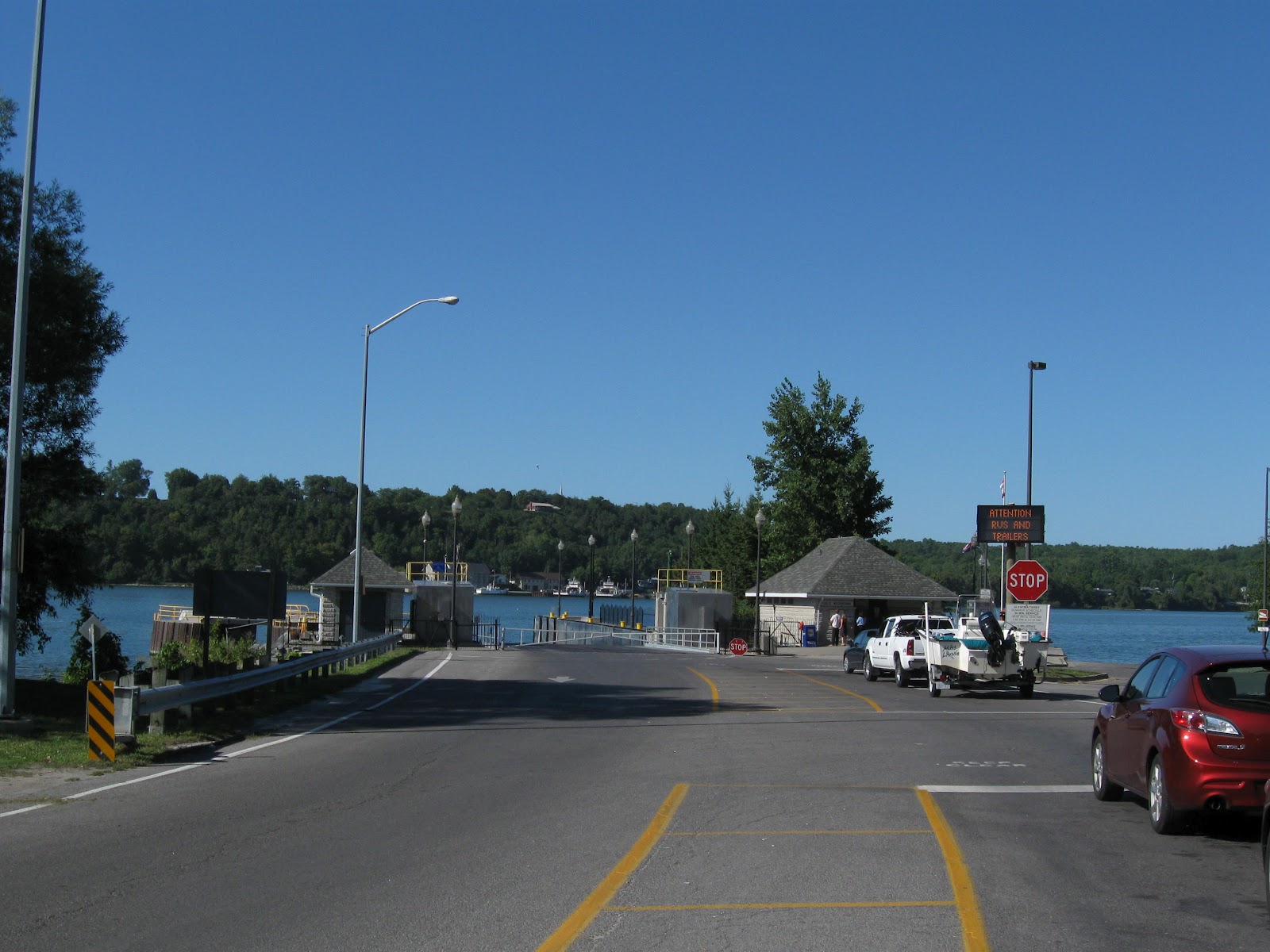
| Glenora Ferry Dock |
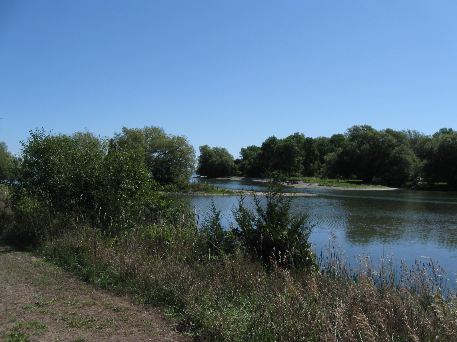
The drive to Long Point, Prince Edward County is such an enjoyable trip. I took Hwy # 4 to Hwy #33 which takes you along the shores of Lake Ontario west to the Glenora Ferry.
View of the Bay from the road side.
The crossing was calm, ferry at this time of year is always full today was no different.
After getting off the ferry heading to Picton, I took the first turn left onto Hwy # 7 which took me past “ Lake On The Mountain “. Just past Lake On The Mountain I turned right onto Bradley Rd, it took me to Hwy # 13 which took me past places like Black River and the Black River Cheese Factory, South Bay then out to Long Point which is very exciting. It not only has Long Point Harbour, my launch point, but also to the Prince Edward Point Bird Observatory, Website: http://www.peptbo.ca/directions.html . This is a cool day trip for people interested in birds.
Backing up a bit, while crossing on the Glenora ferry I thought I would call Tim and let him know I would be launching from his harbour within the hour. He replied by saying the lake was in good shape, so I asked him where he was as the background noise was very load, his reply totally shocked me. I’m out in the middle of the lake. My next question was, are you on a satellite phone and his reply was a simple “nope “ just my normal cell…………….hummmmm. Tim then said he had to go as they were beginning to bring in nets, but they will be keeping an eye out for me, we expect you will have no difficulties on your crossing. Good Luck. Cell Phone huh, I think I will take ours with me to the island, I was going to leave it in the truck, but who knows it may work out there.

I arrive at the launch ramp in Long Point with no one around, it’s normally a very quiet little harbour.

I unloaded my kayak and stowed my gear into it's hatches, a task I’m more than familiar with everything in it’s place. At 12:05 I paddle out of Long Point Harbour excited to be in my Kayak and finally starting this trip.
This area is not unfamiliar to us, Brent & I paddled to False Duck Island on June 13th 2012, I can’t believe it was that long ago, wow. My GPS now turned on shows me Main Duck 11.6 miles out.
The bay is calm but as I get further out into open water the Marine forecast was bang on I’m into 1 to ½ meter waves, but they are on a some nice size swells out of the southwest, which means I have to take them on the starboard “ right “ side of my kayak.
My plan was too “ I always have a plan“, Hey you’re out in the middle of water what else do you have to do…. smiling, Ok plan!!, was to allow myself to get warmed up by paddling slowly for about 4 kms, then get into my rhythm. I hope to make the island in 4 hours or less. As I came out of the harbour I could not see Main Duck Island from my kayak. Setting the GPS, I then pointed the bow of the kayak right on the correct direction and checked my bow compass 140 degrees. Off I go just focusing on the waves and my compass, my first four Kms went faster then expected.
 |
| False Duck Island |
I was feeling really good, I always feel best sitting in my kayak . I now had False Duck Island to my port side and Main Duck Island showing way out on the horizon.
 |
| Net Marker |
At about half way I came across a red and white buoy, a fishing net marker, could this be one of Tim’s nets? He did say he would fish in this area just in case I required assistance. Hummmmmmmm. Taking a break I had some munchies and drank a half litre of Gatorade. This Gatorade helps old guys like me from cramping up….smiling. After this 5 minute break it was on with the trip.
 |
| Main Duck Island with Freighter to left |
I can see Main Duck Island clearly at this point, but I can also see something to it’s left. I look and see nothing marked on my maps, so my guess would be a Lake Freighter. Hummmmmm Now midway, I’m hoping I’m well out of it’s way cause it does have the right of way……..smiling. I think size has something to do with it……Yeppers
 |
Don't look at the trip time, GPS stopped
a couple of times, miles are correct. |
At about 2.57 miles off Main Duck I know for sure that this is a freighter, as I continue it was evident that I will need to stop paddling at some point to let this ship pass, he may not even see me out here.
So I paddled for another Km and had another snack break to allow it to pass, I sat for about 15 minutes and I’m glad I did we would have been very close.
Watch the Freighter get closer and closer, you wonder do they see me sitting here?
As the ship past by it flashed a light at me which told me they did know I was there. I quickly began to paddled wanting to get my forward speed up knowing full well this ship would create a very large wake. I was surprised at how long it took the ships wake took to get to me but like any large wave it’s best to just paddle hard through it, which I did smiling
“ what a ride “.
 |
| CSL Assinaboine, Canada Steamship Lines |
Data on the CSL Assinaboine is found at this Website:
http://www.boatnerd.com/pictures/fleet/cslassiniboine.htm
 |
| Main Duck Island Lighthouse |
The Island now about a Km away I thought I would pull out the MS flag and get some photos just in case the shore wave action is to rough. I was glad I did cause it would have been difficult to get pictures closer to shore.
I arrived at the island right at the lighthouse and I was so pleased that it looked first-class.
Shoals off the west point of the island. Lots of sea birds on each rock.
At this point I was feeling pretty good, so I thought I would paddle around to what is known as the harbour.
 |
| Lighthouse Keepers House |
As I paddled east along the shore I came across the Lighthouse keepers house and a cottage type building.
 |
| Paddling the Northwest shore line. |
Continuing on, the shore became a very steep rock face straight to the water. As I rounded the point the water became calm and I could see the rock bottom and lots of very large fish…………man big fish. I should have brought my fishing rod……
Rounding the point into the lees side of the island, very calm bay to the left in this Photo you see Yorkshire Island which is only 1.4 kms from the USA border.
 |
| Add caption |
Beautiful clear water in this bay, Yorkshire Island about 2.2kms away.
The sheer walled shore line. Very interesting spot. I loved the clear waters I saw more large fish I could have cried.
 |
| The inner bay where most of the sailboat anchor. |
Once I got into to bay proper I was saddened to see no boats, this is the bay that sail boat would be anchored. That’s no fun……I was looking forward to meeting new people. I paddle further into the harbour and still no one. Hummmmm no one here couple with the fact that a friends who has been on the island told me, there where more snakes on this side. Made me think of paddling back to the keepers house. Now snakes, I hate snakes. Being the manly man I’m not, I opted to paddle the km back to the keepers house to make camp for sure.
Now as a kayaker this was not the best place to land a kayak with wave full on, as a snake coward it was the best place. So taking my time to select what I thought to be the lesser of all evils landing spot, I paddle the last 100 meters to shore. Well SWEET @&5#4US what is floating right there, was a big grey black snake Grrrrrrrrrrr. It just floated there. Watching it go by I would have loved to have taken a photo of it, but at that time I was dealing with the waves that wanted to push me into the rock shelf which made up this shore line ahead. As it turned out I selected well and my landing was better then I could have expected. As I approached a large wave picked me up and I floated right on to the shelf, with little scraping of the kayak’s bottom. I continuously kept an eye in every direction hoping that frigging snake had not followed me in. They do that you know !!!!!!I As it turns out this snake was not hungry enough to take on a 200 pound kayaker. With waves rolling over my kayak I to slowly exit my kayak safely, slower then I should have, but you know older bones. Standing in knee high water I pulled my kayak to the shore and lifted it onto the first of three rock shelves which made up the shore line here.

It was difficult lifting this loaded kayak up on this shelf, but I just wanted to get away from the snake.....smiling.
My first order of business was to have a pee, then get out my phone and check to see if I had reception. On my first attempt the phone did nothing, so I tried again and for the longest time nothing, then about a minute later it rang. Wouldn’t it be great to let Mollie know I was safely on the island. Mollie picked up on the second ring, she was so please to hear that I had made the island safe and sound. After a short chat about the crossing, I said we should cut the call short as I wanted to save the phones batteries just in case. After lots of I love you ’s she said make sure the snakes don’t eat you……Cute, Just Cute. I told her I would call tomorrow morning, so she would knows if I was actually leaving the island and what time I would start out on my homeward bound trip. How Cool!! That call had make both of us very happy, she now knew that I was safe and I did not have to worry about her worrying. All Good.
 |
| My Little tent is just behind the large tree. |
After the call I went for a little walk to check for a good camp site. As it turned out straight in from my landing point was an excellent tent location, which was about 100 ft from the old Lighthouse Keepers boarded up house. Great, so now I set to the task of emptying my camping gear from the kayak, moving it higher up on shore and making camp.

An hour later all done I was not yet ready to make dinner, I thought time to explore and maybe get some lighthouse shots with the MS Flag. I head west along the shore line enjoying the strong breeze which blew from the west across the full length of Lake Ontario. 400 meters from my camp I hit the lighthouse. I was please to see that this lighthouse was still in fairly good shape. I took a few photos with the flag then rounded the end of the island and hiked to the next point.
I believe this was the old weather/ communications building. Notice: the shore was covered with shells/zebra muscles at this end of the Island.
Shells/Zebra Muscles which has washed up on shore all along the west end of the island. Makes for a nice looking beach.

Main Duck Island Lighthouse from the southwest side.
Getting a little peckish I started back for camp.
It was at this time I turned on my GPS and thought about looking for a couple of Geocaches on the way back.
 |
| Main Duck Geocaches |
The first cache was called Library Cache and yes it was and I have to Thank the gentleman who place this cache here, as I had forgotten a book to read, I did check out a book “ The Proving Ground “ which I’m just about finished. For anyone who enjoys water, boats and a challenge this is a must read.

Library Cache hide with old cottage in the background.
My next caches “ Main Duck Lighthouse” coordinates lead me down an old grassed over concrete walk, that lead me past an old run down cottage, on back to the keepers house and then past my camp by 30ft.
Another great find, I scored a “ TB “ Travel Bug. Travel Bugscoin type thing with a registration number that allows you to research it’s log on Geocaching.com. It also shows you where it has been. TB’s must be placed into another cache, you it’s finder, are just one step in the Travel Bugs journey. They are fun to find and fun to see where they have been.

I can't believe these caches, they are awesome very cool shuff, besides the TB'S Thanks to the Cache owner.
The next cache was about 650 meters inland a nice walk which took me down a tree cover path into the middle of the Island.
As I broke out of the woods I was surprised to see a field of this size in the middle of the island. My next cache “ The Long Walk “ was an easy find.
Wow, I scored a second TB. How Cool is this, who would have thought, people would leave a TB out here. Thank You these Canadian TB will be going to Florida with Mollie in Sept.
It was now later in the day, I was getting really hungry. I had forgotten about food when I started finding the caches. Turning to head back to camp, Grrrrrrr I met my second snake of the day. Eye to eye we looked at each other I jumped and I think he thought I was more hungry then he was so he slid into the high grass. Once again I manage to get away with my life……….smiling.

On the way back through the wood heading to my camp I came across this. Not sure what it may have been, but it seems to make a cross roads in the paths.

20 minutes later I arrive back at camp, I decided it would be safer to cook dinner on the rock shore over the high grassy area around the keepers house. That would be News, Huh!!! Second kayaker in 8 years to burn a building down on Main Duck Island. I couldn’t even imagine.

Dinner was dried veggies and beef jerky boiled till soft then I added a Lipton’s chicken pasta sidekick. It is really good. Well it’s my recipe, so I’m bias.
 |
If you click on photo you can enlarge it
you will actually see False Duck & Long Point. |
I eat my dinner looking out over the lake with waves noisily breaking on shore just feet away and the strong breeze blowing through the tree behind me, it hit me this was an awfully loud place to be. Really it was incredibly noisy. It was at that moment I truly realized I was all alone on this Island.
 |
| Notice the Keepers house in background. |
Before the sun completely set, I need to get the last of my chores out of the way, dishes done and put away, I had to purify 5 to 6 litres of water for the next day and ready my gear for an early start in the morning, if weather permitted.
Chores out of the way I crawled into my single man tent. I looked up and there in front of me was a quarter moon framed by tree. I took a photo through the screen of the tent. It was a great sunset. I put my head down to try and fall asleep. Nope, sleep would not come I was having difficulty falling off, so I read.
I read till late into the night and every time I thought I was ready, I would close my book and bang my thoughts returned back to the loud shore noises, the winds and waves. Thoughts then returned to that one question. Will I have good weather to get off the island in the morning, I was prepared to spend up to three days on the island, but really did not want to. Part way through the evening I turned on my marine band radio to get the Eastern Lake Ontario forecast, it was still the same 10 knots winds out of the west, with wave 1meter decreasing to 1/2 meter late morning. Not prefect but pretty close. But the noise of the breaking waves, kept me thinking it could be wrong. At some point I had fallen asleep and when I woke the sun was just rising.
 |
| Sun rising in the east. |
I crawled out of the tent and headed for the shore, the waves looked just about what they had called for 1 meter to 1/2 meter. It looks like the waves on my trip back to Long Point would be hitting me on the port side all the way back to Long Point Harbour. We I go????
 |
| Kayak loaded ready to head out. |
In seconds I planned to leave the Island right away. I broke camp and loaded my gear into the Kayak.
I did my final check of the area and was satisfied everything was clean and I was ready to go. One last thing, I pulled my cell phone from my deck bag and called Mollie. At around 07:35 she sounded please to hear from me. I told her I was leaving the island and all looked good for my trip back to Long Point Harbour. She wished me a good crossing and told me to call her when I hit shore. Hugs and I love you’ s said, we ended the call. I place the phone in the ZipLock bag and placed it back into my deck bag.
Ready to go I lifted my fully loaded kayak off the rock shelf and placed it into the water. I quickly walked it to the edge of the next shelf with waves trying to fill my cockpit. I slid into the kayak and rapidly paddled through the next group of small breakers.
Once off shore, away from the breaking waves, I stopped and sponged out the water from my cockpit and put on my paddle skirt. Now ready for a paddle.
 |
| Leaving Main Duck , beautiful clouds. |
Once I got away from the island and the effect it had on the waves I found that I was dealing with something new to me. Large rolling swells from the port side wanting to push me to the right but the small waves on top of the swells heading the opposite direct moved me to the left. I had the feeling of being in a washing machine. Really kind of fun and it was interesting enough to keep me thinking about what I need to do.
I could just see False Duck as a bump on the horizon, can't believe my good fortune, this weather is great.
 |
| False Duck and it's Lighthouse |
At this point False Duck appeared to be just off my right but I knew better I knew better it would be like 6 kms away. The waves seemed to have fallen off a fare bit at this point.
However, once I did get parallel with False Duck Island I could not believe how calm the water had become. As I passed over William’s Shoal which in normal years would be 12 to 15 ft below the surface, I could actually reach down with my paddle tip and hit the rocky bottom, amazing.
I was pleased to have calm waters here, I was paddling over incredible underwater views and the calmness of the water made it possible to see and enjoy. I most have counted over 20 very large carp and several other fish which where to quick for me to identify.

Thrilled with my good fortune I slowly paddled along the 1.5 km shoal taking in all it’s treasures.
As the water below me deepen I finally looked up and out at the Lake. It was the closest I have ever seen it to dead calm. I turned my kayak to the middle of the Lake and I took photos of the low clouds over the water, exquisite.
Turning back onto the correct heading, Long Point straight ahead it looked like it could have been an Island. Paddling now was a treat and I now could actually make out the lighthouse at the end of the point.

About 20 minutes later I was entering Long Point Harbour, I look to see if Tim was out fishing and he was I will be sorry to miss him.
As I approach the launch ramp next to Tim’s Dad’s pier I see four people watching me approach shore. I asked if they were my welcome home committee and they quickly asked where I was coming from. I told them about my little adventure and they said they were please to welcome me home, with smile on their faces. Before sliding out of my kayak at shore, I check my GPS before turning it off, trip time 2.49 minutes 18.1kms. I must have taken a little tour over the shoal and added a couple of 100 meters. But 2 hours 49 minutes, that is better then I ever would have expected.
As I walked up to my waiting truck the group introduced themselves. We chatted as I unloaded my gear and Bill offered to help load my kayak onto the roof of my truck. Bill’s wife quickly suggested that I’d be better off without Bill’s kind offer……smiling. Now chatting most with Bill he tells me that he is an Author and he thinks I should write a book. I smiled and said I would leave that to people like him.
Bill gave me his card and wrote down his new website on the back, so I gave him this blog address. For Bill, you are truly an interesting guy and your lovely wife took a couple of great photos of me at the launch, Thank You.
William E. McLeod “ The Chapleau Game Preserve” Website: billmcleodbooks.com What an adventure this summer has been, so many kind, interesting folks. Hummmmmm did I say “ Shore People “ Bill thanks for the great chat I will be looking your true mystery books up. Bill and group headed out as they were going to the bird observatory for it’s daily interpretive session.
I loaded the kayak and changed into my last clean shirt and shorts and headed for home. As I approached Black River, Mollie’s words screamed out, stop and get an ice cream on the way home. So I did, the largest mint chocolate chip I could buy…mmmmmmmmmmm it was great.
I enjoyed my return trip on the Glenora Ferry and looking around at all the tourists on board I began to think, all of them like myself are on their own little adventures. Life is good.
I arrived in our lane way around 1pm off loaded my kayak and phoned Mollie at work, she was happy I called. I then began the task of cleaning all my gear before Mollie got home from work. She arrive home and we sat in our garage and she listened to this story while we drank a very very cold beer. Life is good.
I wish to Thank, Tim McCormack the commercial fishermen out of
Long Point Harbour. Thanks for being my Guardian Angel on this trip.
It was a comfort knowing you were close by.
Once again folks remember we are raising
Awareness & Funds for the Multiple Sclerosis Society of Canada, Kingston
Chapter. If you wish to make a donation/pledge please call the Kingston Chapter
at 613-384-8500 . Tell them you wish to pledge to
“ 20 Years To Enlightenment “ and it all stays
in the Kingston and area.

 Third vehicle off the Wolfe Islander , I raced across the island to line up for Horne’s Ferry. I arrive to find there was no in line. Awesome, Also to add to my good fortune, the ferry was just coming into dock. This ferry is small, so I know they will put me on last and right across the center. The Ferry’s Captain arrived at my window for payment and to my surprise he only charged me half price, some how he knew about our MS Paddle Project. “ Shore People “ Wow !!!! What a great day.


 After the first couple Kms I’m very please at my progress, the waves are hitting me from the right rear of the boat and they are not very large. Oh Oh at around 7 km off the main land the waves started building but the boat was still handling them fine but, I had to stop three times and flip the kayak back over. It would fly off the waves and spin in the air landing up side down.